Things to do
Xung Khoeng Waterfall: commune, distance, season
Which commune Xung Khoeng Waterfall belongs to after the merger, how many km from Pleiku, the route, the best months, and notes on slippery paths, mossy rock and entry tickets.
By Vương Nguyễn and teamRechecked
Published · 10 sources ↓
On this page
- Where Thac Xung Khoeng is and which commune it belongs to now
- How far from Pleiku, and which road
- What the waterfall looks like and how high it is
- Which months are best
- Slippery paths, mossy rock, strong water: safety
- Entry ticket and opening hours: who to ask before you go
- What to pair it with for a full day
For a day trip from Pleiku to Xung Khoeng Waterfall (Thac Xung Khoeng), settle three things before you get on the bike: the commune’s current name, the real distance, and who to ask about tickets. The fall is far from town, the road in has weak signal, and the commune name changed with the merger. Then pick your season and hour. Other places around town are in things to do around Pleiku.
Where Thac Xung Khoeng is and which commune it belongs to now
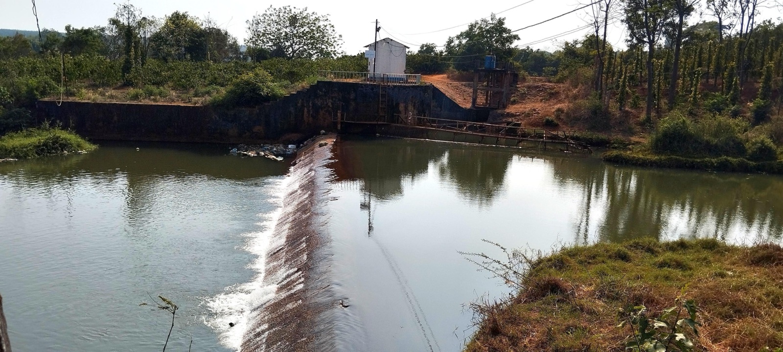
The national tourism administration and the national tourism database both place the fall in xa Ia Me, Chu Prong district, Gia Lai province. That is the administrative name from before 1 July 2025, so you need one more step: Resolution 1664/NQ-UBTVQH15 merges the whole area and population of xa Ia O, xa Ia Me and xa Ia Boong into one new commune (clause 49). Put the two sources together and the fall is in the old xa Ia Me, now part of xa Ia Boong.
This changes how you ask. When you look up a phone number for the People’s Committee or ask a local, say “xa Ia Boong”; “xa Ia Me, Chu Prong” is the name you will still see on the national tourism sites, so do not be thrown by two names for one place. On Google Maps, search “Thac Xung Khoeng”; the spot has Plus Code PVQ2+4PM.
How far from Pleiku, and which road
Measured on Google Maps on 3 November 2026, it is 40.2 km, about 59 minutes, from Quang truong Dai Doan Ket to the fall. The fastest route runs along Highways 14 and 19, then turns onto DT663 at Bau Can. Treat Bau Can as your marker: once you pass it, only the last stretch on DT663 remains.
| Leg | Distance | Note |
|---|---|---|
| Quang truong Dai Doan Ket to the fall | 40.2 km | about 59 minutes |
| Highways 14 and 19 to the DT663 turn at Bau Can | 29.4 km | longest leg |
| DT663 from Bau Can to the fall | 10.5 km | about 14 minutes |
Round trip, you spend nearly 2 hours on the road, not counting time at the fall, so leave early and be back before dark. We recommend you download the map before turning onto DT663, because phone signal in this area is unreliable. If you have no bike yet, read how to rent a motorbike in Pleiku before you fix the day.
What the waterfall looks like and how high it is
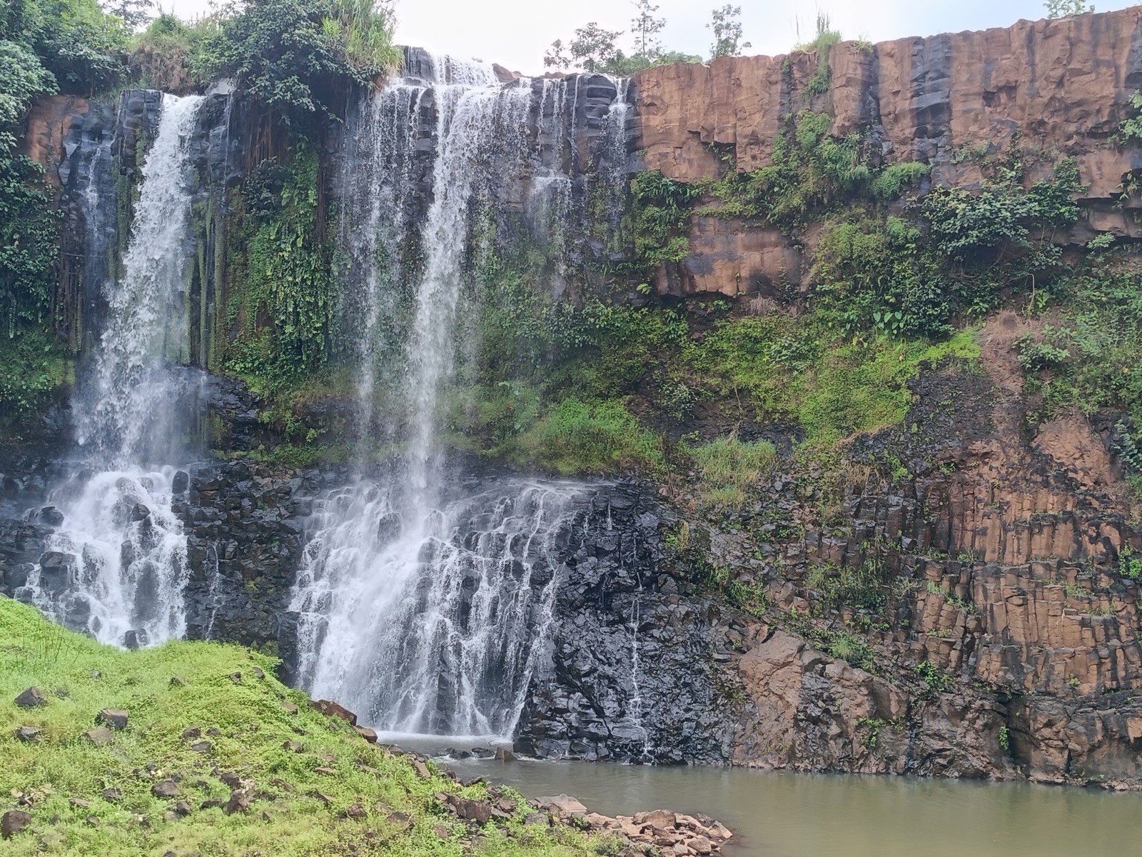
The fall is about 40 m high, per travel sites, a rough figure but enough to picture it. What you notice more standing in front is the width: a broad, fairly flat face with thick vegetation on both banks.
The water bends along the rock slope, hits rocks standing in the stream and throws up white spray, then runs through gaps in the rock and over grass into a clear pool against the cliff. On some bright mornings, white mist rises from the fall like steam off water. Stay long enough and you hear the steady deep sound of water against the cliff.
The villages of the J’rai people are near the fall, so move gently, speak softly and take your rubbish home, as you would anywhere people live next door.
Which months are best
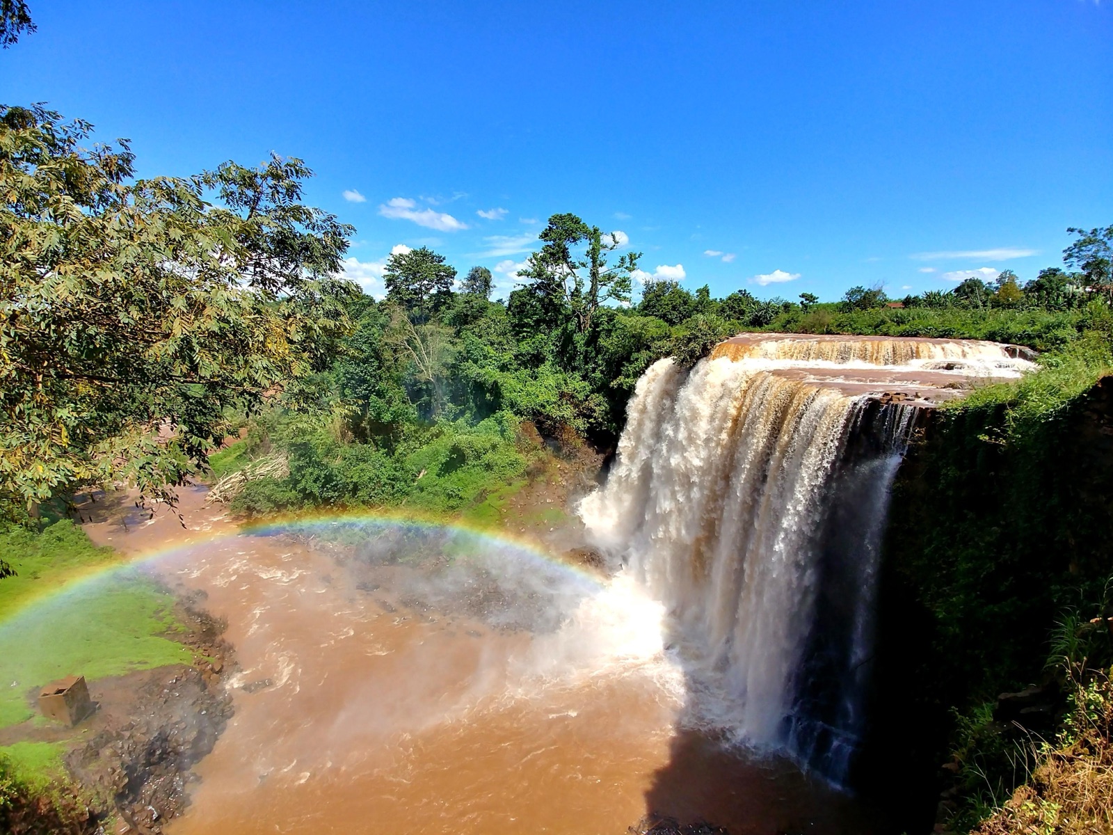
The fall has two quite different faces. In the wet season, May to October, the flow is strongest and the water rushes and sprays white, but the paths can be slippery. In the dry season, November to April, the weather is cool, the flow gentler, and the scenery gets brighter with wild sunflowers (da quy) from November to December.
If you pick only one season, the dry season, November to April, is easiest: good sun, little rain, convenient for sightseeing. The fall is wider then, with mossy rocks stacked on each other in weathered, mottled colours. We recommend the dry season for a first visit; if you want a full-water fall, go in the wet season but watch the forecast and avoid days of heavy rain.
For the hour, go early in the morning, when soft sunlight falls through the water. It is good for photos and leaves you time to get back the same day.
Slippery paths, mossy rock, strong water: safety
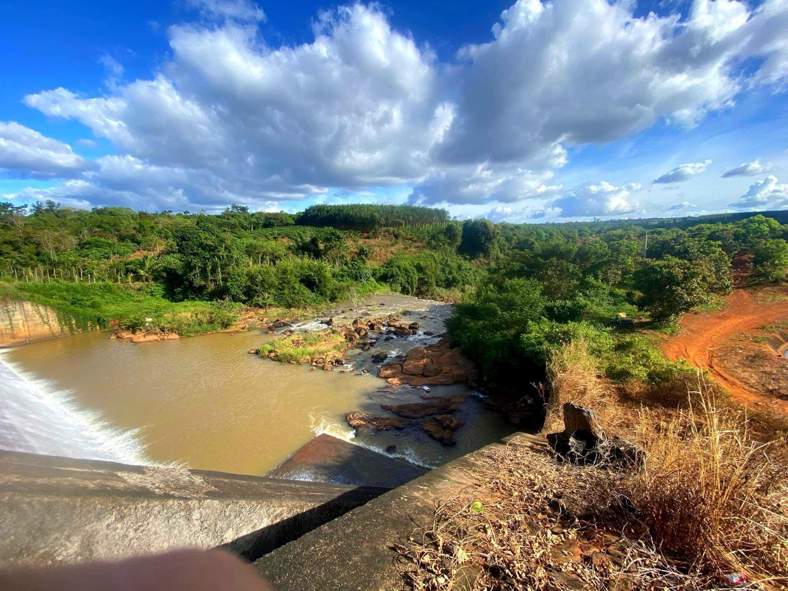
We recommend watching the fall from the bank and staying out of the water. The foot of the fall has stacked, mossy rocks, in the wet season the water rushes and the paths can be slippery, so non-slip shoes and drinking water are the two things to bring. In the wet season, add a light raincoat.
The way to the fall is not very hard but still takes preparation. The trekking path is of medium difficulty, with steep slopes that call for good fitness, and the difficult terrain is the biggest drawback of this trip. Check the weather forecast first to avoid days of heavy rain.
Because phone signal is unreliable, bring a backup way to communicate and tell someone at home when you plan to be back. Standing at the rock edge and looking down at the stream bed is lovely, but keep your distance there if the rock is wet.
Entry ticket and opening hours: who to ask before you go
For the entry ticket, opening hours and parking, do not assume it is free or open all day. The surest way is to ask UBND xa Ia Boong, where the fall lies under the commune-merger resolution, the day before, since signal is weak on the road in.
When you call, ask about four things: whether there is a ticket, the closing time, where to park, and any repair work or blockage on the road to the fall. The destination page of the national tourism administration gives you the scenery description; operating information you have to ask for on the spot.
What to pair it with for a full day
With nearly 2 hours of riding there and back, Xung Khoeng suits a day of its own better than a morning squeezed into a multi-stop trip. Nearby are Doi 3 waterfall, Doi 5 waterfall, Chu Prong mountain and Bau Can tea hill; Bau Can is also the DT663 turn on the way to the fall.
If you like day-trip waterfalls, compare it with Phu Cuong Waterfall. To line up several places near Pleiku by distance, weekend trips near Pleiku suits better, and if you have not picked where to stay, see which area to stay in when you come to Pleiku.
Questions
Which commune is Xung Khoeng Waterfall in?
The national tourism sites list the fall in xa Ia Me. Since 1 July 2025, the Gia Lai commune-merger resolution has merged xa Ia Me with xa Ia O and xa Ia Boong into a new xa Ia Boong, so today use the name Ia Boong when you ask directions or contact the People's Committee.
How many km is it from Pleiku to Xung Khoeng Waterfall?
From Quang truong Dai Doan Ket, Google Maps measured 40.2 km, about 59 minutes, read 3 November 2026. The fastest route takes Highways 14 and 19 to DT663 at Bau Can after 29.4 km, then 10.5 km more on DT663.
How high is Xung Khoeng Waterfall?
About 40 m, per travel sites. It is a rough figure, enough to picture the scale; standing at the foot you will see for yourself how high the water drops down the rock slope.
Is there an entry fee at Xung Khoeng Waterfall?
Ask UBND xa Ia Boong, where the fall lies under the commune-merger resolution, about the ticket price, opening hours and parking before you go. Do not assume it is free or open all day: the road in is long and phone signal is weak, so finding out on arrival leaves you little room to adjust.
Which month is best for Xung Khoeng Waterfall?
In the wet season, May to October, the fall is strongest but the paths are slippery. In the dry season, November to April, the weather is cool, the fall gentler and the trip easier. Go early in the morning, when soft sunlight falls through the water.
Should I swim at Xung Khoeng Waterfall?
We recommend not swimming. The foot of the fall has stacked, mossy rocks, in the wet season the water rushes and the paths can be slippery. Watch the fall from the bank and wear non-slip shoes.
Read next
Sources
(10)
- Thác Xung Khoeng - Điểm đến (Xung Khoeng Waterfall, destination page)
- Thác Xung Khoeng (Cơ sở dữ liệu du lịch quốc gia) (National tourism database)
- Toàn văn Nghị quyết số 1664/NQ-UBTVQH15 sắp xếp các ĐVHC cấp xã của tỉnh Gia Lai năm 2025 (Resolution 1664/NQ-UBTVQH15, full text)
- Google Maps chỉ đường: Quảng trường Đại Đoàn Kết đến Thác Xung Khoeng (Google Maps directions)
- Hùng tráng thác Xung Khoeng và núi Chư Hơ Rông, Gia Lai (Vietravel)
- Thác Xung Khoeng – Bản tình ca trong trẻo của núi rừng Tây Nguyên (Cao Nguyên Tourist)
- Thác Xung Khoeng - Thác nước đẹp hùng vĩ giữa phố núi Gia Lai (iVIVU)
- Thác Xung Khoeng (cung đường) (ExoTrails route)
- Du lịch Gia Lai 2023: khám phá những điểm đến tuyệt vời nhất (Mytour)
- Khám phá ngay 5 điểm du lịch đặc biệt tại Chư Prông, Gia Lai (Mytour)
Photos
(3)
thi binh le · Cường Nguyễn · thu nguyen thi
Spotted an error? Send a correction · How we choose sources